Template:Featured Image/August, 2009
From CSU-CHILL

|
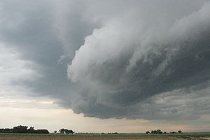
Arcus cloud Around 0008 UTC on 3 July 2009, a thunderstorm outflow boundary passed the CSU-CHILL radar site. Low level convergence along this outflow boundary produced an arcus cloud. (The view is looking east from the east fence line at the radar site.) Photo credit: Pat Kennedy |