Hailstorm observation of 20 June 2008
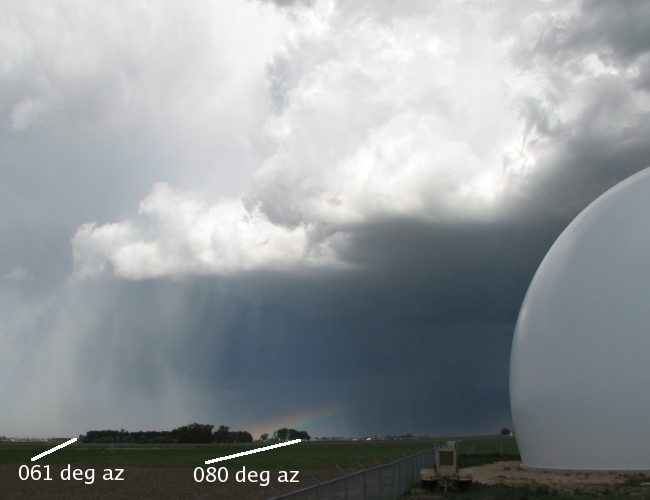
On 20 June 2008 radar operations were conducted to further evaluate the performance of the new dual offset feed antenna that came into service on the CSU-CHILL radar during the preceding month. Near 2300 UTC a hail-producing thunderstorm intensified a short distance northeast of the CHILL radar site. The photograph shown below was taken at 2302 UTC; two radar azimuths to features visible in the image have been added.
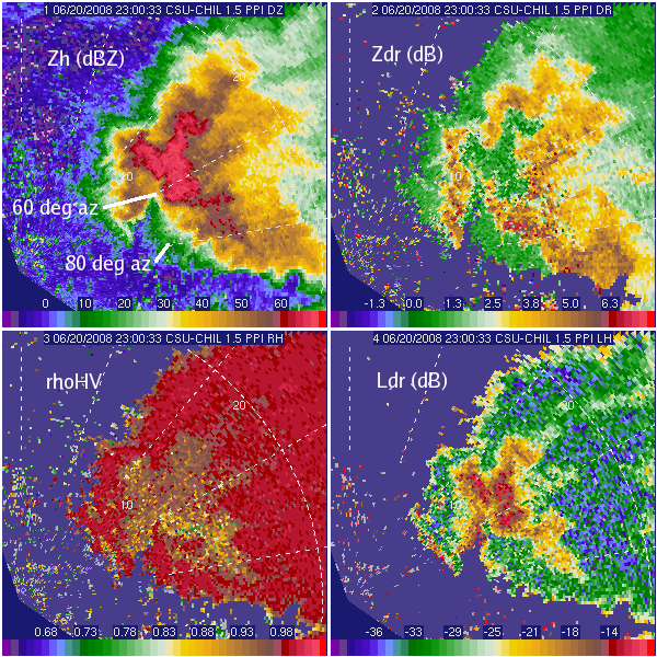
Selected data fields from a 1.5 degree elevation PPI scan done through the storm at 2300 UTC (two minutes before the photograph) are shown below. Due to the new antenna’s low sidelobe levels, minimal ground clutter return is present in the reflectivity field at short ranges (the azimuth reference lines begin at 10 km range.) The near-zero Zdr and reduced rhoHV patterns clearly indicate the presence of hailstones in the higher reflectivity core region. The hail area is also associated with a significant amount of depolarization as the Ldr levels reach ~ -15 dB. Notably small Ldr values (i.e., frequently reaching -35 dB and below) are seen in the lower reflectivity / lighter rain areas of the storm. It appears that the dual offset feed antenna permits the CSU-CHILL radar to measure Ldr values down to the -35 to -40 dB range; this is an improvement of ~6 dB from the performance limit attained by the previously-used center fed antenna.

