Tornado Observation from May 22, 2008
From CSU-CHILL
<gmap lat="40.65" long="-105.05" zoom="12" width="600" height="600" showlabels="on" showscale="on">
points:
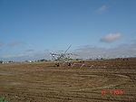
40.66473|-105.01583|Irrigation Pivot  Damaged Irrigation Pivot
40.68169|-105.07159|Nursery
40.71173|-105.09533|House
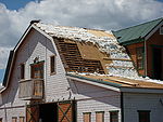
  Damage to a house
40.71812|-105.09726|Barn
  Roof damage to a barn
kml:
http://www.chill.colostate.edu/kml/20080522/CHL_1823_dBZ.kml%7CdBZ
http://www.chill.colostate.edu/kml/20080522/CHL_1823_Vel.kml%7CVelocity
http://www.chill.colostate.edu/kml/20080522/CHL_1823_RHO.kml%7CRho
http://www.chill.colostate.edu/kml/20080522/CHL_1823_ZDR.kml%7CZDR
</gmap>