Template:Featured Article/January, 2016
From CSU-CHILL

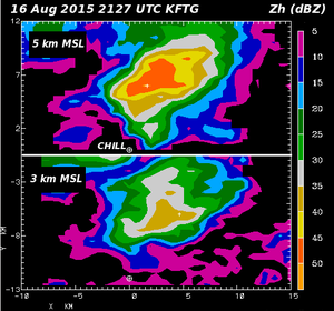
NWS KFTG (Denver) reflectivity data at the 5 km (top) and 3 km MSL (bottom) CAPPI heights at 2127 UTC on 16 Aug 2015. The developing thunderstorm just north of the CSU-CHILL radar has greater reflectivity values at 5 vs. 3 km. The subsequent development of dual polarization hail signatures near the ground has been documented. (Full Article...)