Template:Featured Article/April, 2015
From CSU-CHILL

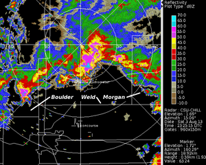
Thunderstorms extending across several Colorado counties as shown by CSU-CHILL reflectivity data collected in a 1.7 deg elevation angle PPI scan on 3 August 2013. High resolution (~1 minute scan interval) time lapse image loops documenting the evolution of the low level reflectivity and radial velocity fields in the echo area immediately southeast of the radar have been assembled. (Full Article...)