DPWX/High time resolution PPI scans of thunderstorm precipitation: 30 July 2017: Difference between revisions
Pat kennedy (talk | contribs) No edit summary |
Pat kennedy (talk | contribs) No edit summary |
||
| Line 1: | Line 1: | ||
==Overiview== | |||
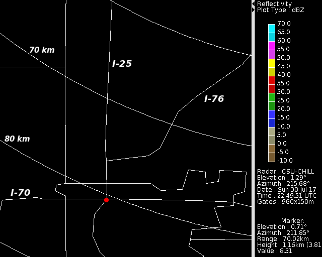
An isolated thunderstorm complex moved southward into the area located just north of the city of Denver during the late afternoon hours of 30 July 2017. CSU-CHILL radar observations of this storm were made using PPI sector scans composed of just two low elevation angles (0.7 and 1.3 deg). This restricted scan pattern allowed the sweeps to repeat at an ~1 minute time interval. The storm generally followed interstate highway I-25 as it approached Denver. For reference, I-25 as well as two other interstate highways are marked in the following base map. A red dot marks the intersection of I-25 and I-70, this intersection is located within the northern portion of the city of Denver's irregular boundary. | |||
[[Image:30jul2017 vchill base anot.png|center]] | [[Image:30jul2017 vchill base anot.png|center]] | ||
| Line 4: | Line 6: | ||
==Reflectivity loop== | ==Reflectivity loop== | ||
The following loop shows the reflectivity data in the 0.7 degree elevation angle PPI sweep. (At the time of the image capture, the elevation angle shown in the annotation block has changed to the second sweep angle.) In the early frames of the loop, a westward-moving outflow boundary can be seen near the left edge of the images. A major aspect of the echo evolution is the sequential development of new reflectivity maxima in the immediate vicinity of I-25. Apparently following the outflow boundary motion, these high reflectivity regions appear at more westward locations with time. The peak intensities in these cores briefly reach levels of 55 - 60 dBZ. | |||
<center> | <center> | ||
<imgloop delay=200 imgprefix="http://www.chill.colostate.edu/anim/sept_2017_30jul2017_I25_rain/" width=640 height=512> | <imgloop delay=200 imgprefix="http://www.chill.colostate.edu/anim/sept_2017_30jul2017_I25_rain/" width=640 height=512> | ||
Revision as of 06:28, 24 August 2017
Overiview
An isolated thunderstorm complex moved southward into the area located just north of the city of Denver during the late afternoon hours of 30 July 2017. CSU-CHILL radar observations of this storm were made using PPI sector scans composed of just two low elevation angles (0.7 and 1.3 deg). This restricted scan pattern allowed the sweeps to repeat at an ~1 minute time interval. The storm generally followed interstate highway I-25 as it approached Denver. For reference, I-25 as well as two other interstate highways are marked in the following base map. A red dot marks the intersection of I-25 and I-70, this intersection is located within the northern portion of the city of Denver's irregular boundary.

Reflectivity loop
The following loop shows the reflectivity data in the 0.7 degree elevation angle PPI sweep. (At the time of the image capture, the elevation angle shown in the annotation block has changed to the second sweep angle.) In the early frames of the loop, a westward-moving outflow boundary can be seen near the left edge of the images. A major aspect of the echo evolution is the sequential development of new reflectivity maxima in the immediate vicinity of I-25. Apparently following the outflow boundary motion, these high reflectivity regions appear at more westward locations with time. The peak intensities in these cores briefly reach levels of 55 - 60 dBZ.
|
|
||
|
Differential propagation phase loop
|
|
||
|
Specific differential propagation phase loop
|
|
||
|


